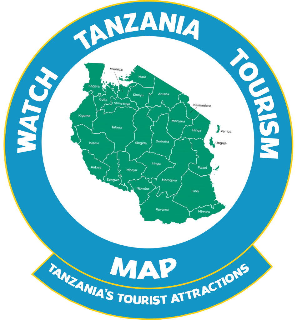
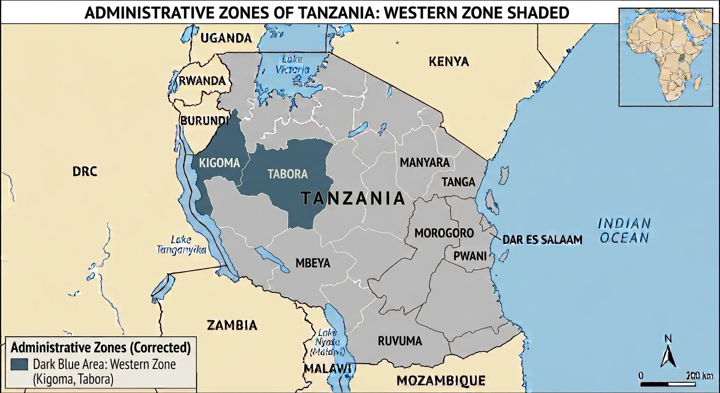
Western Zone Regions
Western Zone Regions comprises particularly the western parts of Tanzania – typically Kigoma and Tabora regions respectively.
Regions & Map of Tanzania
- Kigoma Region
- Tabora Region
Kigoma Region Profile (Fast Facts) & Map/ Main places
Buyungu,Muhambwe,Kusulu Urban,Kasulu Rural,Manyovu,Kigoma Urban,North Kigoma,South Kigoma
Kigoma Region in Brief
- The bustling town of Kigoma is the regional capital of western Tanzania and a central port in the area. Located on the eastern shores of Lake Tanganyika, Kigoma is surrounded by rugged mountains and forests that make it a pleasing and beautiful location. In the past, Kigoma has been in competition with nearby Ujiji, but over the last decades Kigoma has gained a strong economic foothold in the region and its port is of central importance to the activities of the area. Historically, the town was the final stop of the Central Line Railway, built in the 20th century to transport agricultural goods from the African hinterland to the East African coast. The town makes a good overland base for visits and chimpanzee safaris to both Gombe Stream National Park and Mahale Mountains National Park.
Getting There to Kigoma Region
- Kigoma Region can be reached easily through the central road from Dar es Salaam through Morogoro, Dodoma and Tabora to Kigoma. Also through the Central Railway Line from Dar es Salaam through Morogoro, Dodoma and Tabora to Kigoma. By Lake Tanganyika waterways – the Region can be reached from Mpulungu, Zambia, Kalemie, Baraka and Kivu, Democratic Republic of Congo (DRC): and Bujumbura, Burundi to Kigoma, and by flight Airways the region can be accessible from Dar es Salaam and Mwanza, Tanzania; Bujumbura, Burundi, and also it is possible to fly from Lubumbashi, Democratic Republic of Congo (DRC) to Kigoma.
Tourism Attractions in Kigoma Region
- Ujiji village
- Mahale Mountains N/ Park
- Gombe Stream N/ Park
- Lake Tanganyika
- Moyowosi Game Reserve (Established in 1981, with an area of 6000 sq.km, in kigoma).
Tabora Region Profile (Fast Facts) & Map/ Main places
Tabora Urban,Igalula,North Uyui,Sikonge,Urambo,Kaliua,Ulyankulu,Nzega Urban,Bukene,Nzega Rural,Igunga,Manonga
Tabora Region in Brief
- The Tabora Region, of which Tabora city is the capital, is to be found in the north – western quarter of mainland Tanzania. It shares its borders with six (6) regions. Moving clockwise from the north, they are Shinyanga and Simiyu (north), Singida (east), Mbeya (South), Katavi (Southwest) and Kigoma (west). Tabora is physically the largest of Tanzania’s 31 regions, with a surface area of 76,151 sq. km, just over two – thirds of this consists of Forest Reserves (34, 698 Sq.km) and Game Reserves (17,122 Sq. km). Most of the region lies at an altitude of 1,000 – 1500m (the city’s altitude is 1000m) and has a moderate tropical climate, with temperatures reaching their peak in September – October, just before the start of the rainy season. Rainfall is seasonal and occurs mainly from November to April. In the western parts, rainfall totals over 1000mm, while in the east it drops to 700 mm or less. The daily mean temperature is around 23 degrees C. There is a slightly cooler period from May to July, when temperatures can drop to 14 degrees C at night, although they reach 28 – 30 degrees C during the day. Economic activity in the region revolves around farming and livestock keeping, along with related activities such as bee – keeping, fishing and lumbering. The region is estimated to have 2. 4 million ha of cultivable land but less than a fifth of that is actually under cultivation. Most farming is subsistence farming, with maize the leading staple food. Other food crops are rice, sorghum, cassava, and beans. Cash crops are tobacco, cotton, sunflower and groundnuts). Administratively, the region consists of seven (7) districts: Nzega and Igunga (north), Tabora urban (center), Uyui (east), Sikonge (south) and Urambo and Kaliua (west).
Tabora Region Historical Background
- Tabora was founded in the mid – 19th century by Arab traders and lay at the junction of major caravan routes. It was taken over by the Germans in 1891 and became an administrative centre of German East Africa. The name Tabora is said to have originated in the word “Matoborwa” meaning boiled and dried sweet potatoes, a staple food of the Nyamwezi who are the main ethnic group in the region. The town was an important mission station during the early years of the European exploration of East Africa. Stanley and Livingstone stopped in Tabora after their famous meeting in Ujiji (near Kigoma) in late 1871. The Arabic – style house where Livingstone stayed in Tabora is now the Kwihala Museum, which is dedicated to Livingstone and contains his memorabilia including letters, maps, pictures and a diary. It also displays information about other early missionaries and explorers. Tabora is also known for its educational institutions. President Nyerere himself, the founding father of the nation, went to the Tabora Government Secondary School, the first boarding school in the country, and thought highly of it.
Tourism Attractions in Tabora Region
- The major reserve in the region is the Ugalla Game Reserve (Established in 1965 – currently upgraded and established as a National park, and is known as ‘UGALLA RIVER NATIONAL PARK’. This national park is found in Tabora and Rukwa) respectively, with an area of 5,000 Sq. km that supports a large variety of game congregating in the vicinity of the Ugalla River in the dry season. Ugalla River National Park is about 200 km from Tabora city and is characterized by two primary ecosystems: extensive miombo woodland and large floodplains. An estimated total of over 50,000 animals inhabit in Ugalla River National Park for all or part of the year. The species include lion, leopard, elephant, hippo, giraffe and buffalo, as well as impala, waterbuck, topi, wild dog and warthog. The other major reserve is the Kigosi (Established in 1983 – currently upgraded and established as the National Park and is known as Kigosi National Park, this national park is found in Kigoma, Tabora and Shinyanga regions, and is larger than Ugalla River National Park (7000 Sq.km). The Kigosi has wildlife similar to that in Ugalla. Visitors or tourists can reach the park by the trunk road from Tabora to Mpanda, in Katavi region. In addition to the National parks in Tabora region, there are also a number of tourist attractions within the city of Tabora itself. As widely known, Tabora was founded in the mid – 19th century by Arab slave traders and was a major trading point and stopover for caravans connecting Lake Tanganyika and central Africa with the coastal town of Bagamoyo to the north east. It was also an important mission station during the early years of the European exploration of East Africa. Stanley and Livingstone stopped in Tabora after their famous meeting in Ujiji (near Kigoma) in late 1871. The Arabic – style house where Livingstone stayed in Tabora is now the Kwihala Museum, which is dedicated to Livingstone and contains his memorabilia, including letters, maps, pictures and a diary, it also displays information about other early missionaries and explorers. After the German takeover, Tabora became an administrative centre of German East Africa. The construction of the railway made it even more important. The German Fort Boma, which housed the administrative offices, can be seen in Tabora today. It is still in use (by the military) and is connected with the Tabora railway station by means of an underground tunnel (which is not in use). Other points of interest in the city include the Tabora Boys Secondary School which president Nyerere attended: and the varieties of architectural styles – African, European, Indian – to be found in the city’s buildings.
