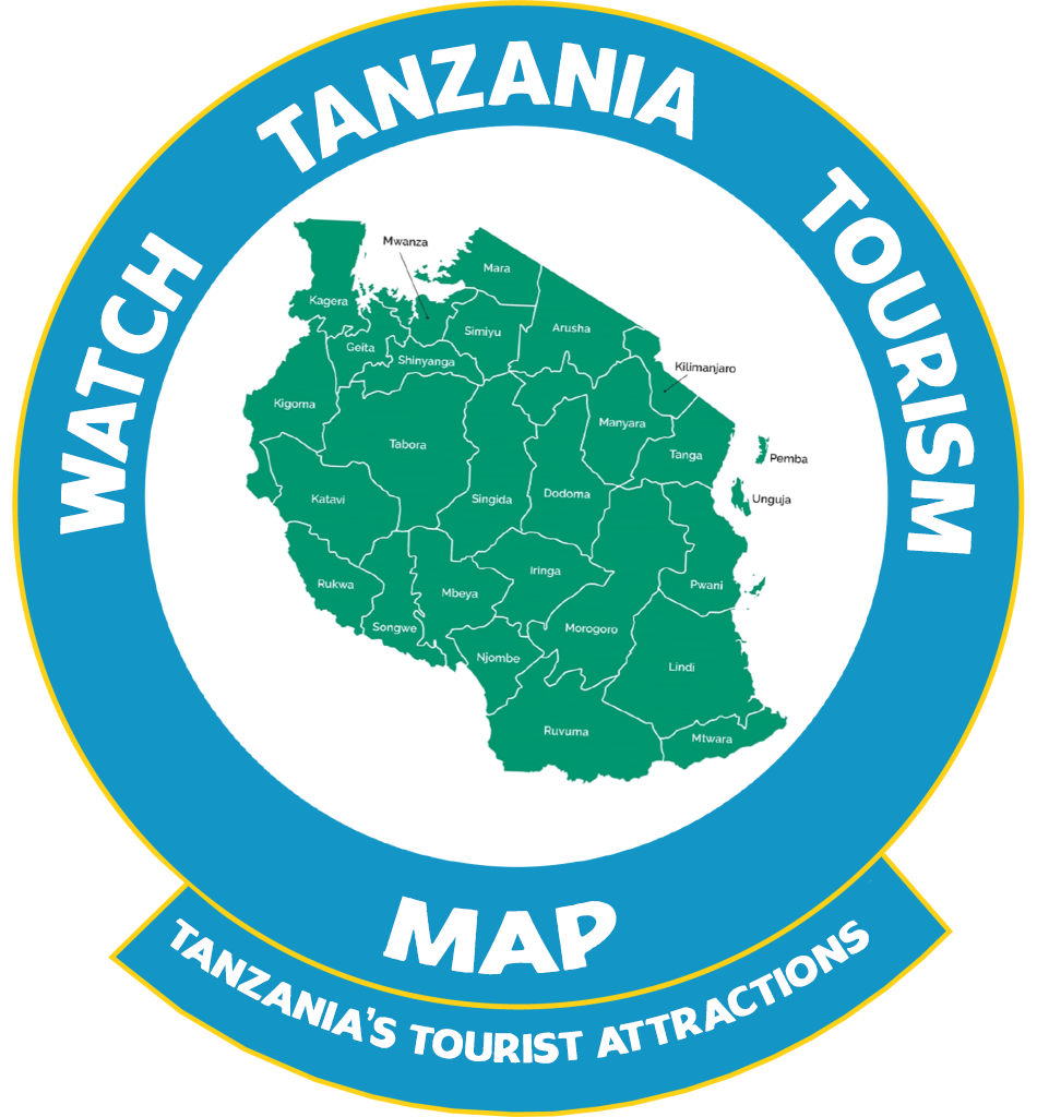
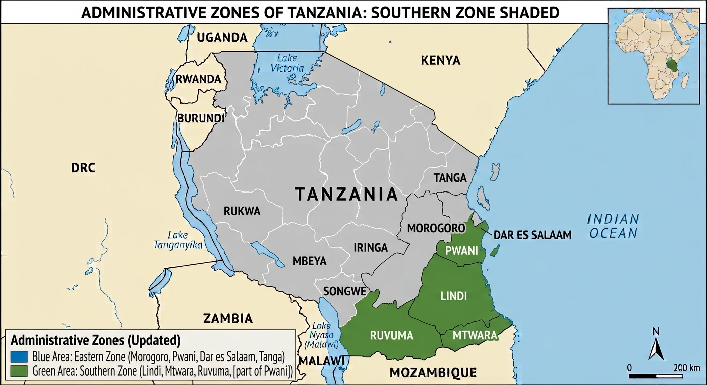
Southern Zone Regions
Southern Zone Regions covers mainly the southern parts of Tanzania, particularly Lindi and Mtwara Regions respectively.
Regions & Map of Tanzania
- Lindi Region
- Mtwara Region
Lindi Region Profile (Fast Facts) & Map/ Main places
Ruangwa,Liwale,Nachingwea,Mtama,Mchinga,Lindi Urban,South,Kilwa,North Kilwa
Lindi Region in Brief
- Lindi Region is one of Tanzania’s 31 administrative regions. It is in the South Eastern part of Tanzania Mainland and is among of the coast regions. The word ‘LINDI’ means a floating bouy or buoyant, and it is home to Dinosaurs at Tendaguru. The regional capital is Lindi Municipal. Lindi is a coastal town located at the end of Lindi Bay, on the Indian Ocean in southeastern Tanzania. The town is 450 Kilometers south of Dar es Salaam and 105 Kilometers north of Mtwara, the Southernmost coastal town in Tanzania, and gives its name to the surrounding Lindi Region, one of the most sparsely populated areas of the country.
Population
- According to the 2012 national census, the region had a population of 864,652, which was lower than the pre – census projection of 960,236. For 2002 – 2012, the region’s 0.9 percent average annual population growth rate was the 29th highest in the country. It was also the least densely populated region with 13 people per square kilometer.
Borders
- The Lindi Region borders Pwani(Coast) and Morogoro Regions in the west, Ruvuma Region in the southwest, and Mtwara Region in the south. Much of the western part of the Lindi Region is in the Selous Game Reserve (Currently parts of this reserve is upgraded as J.K Nyerere National Park, the largest national park in Tanzania and Africa).)
Location:
- Lindi is located at the mouth of the Lukuledi River.
Districts & Populations:
- Kilwa (190,744), Lindi Municipality (MC) (78,841), Lindi Rural (DC) (194,143), Liwale (91,380), Nachingwea (178,964), Ruangwa (131,080).
Tourism Attractions in Lindi Region
- Tendeguru
- Kilwa Kivinje (Kilwa of the casuarines trees
- Kilwa kisiwani (Kilwa Island)
- Kilwa Masoko (Kilwa Market)
- Songo Mnara Islands
- K.Nyerere National Park
Mtwara Region Profile (Fast Facts) & Map/ Main places to visit
Mtwara Urban,Nanyamba,Mtwara Rural,Tandahimba,Newala Urban,Newala Rural,Nanyumbu,Ndanda,Masasi,Lulindi
Mtwara Region in Brief:
- Mtwara Region is one of Tanzania’s 31 administrative regions. The total area is 16,710 Sq.km (6,450 sq. mi). The regional capital is the municipality of Mtwara. Mtwara Is home to the natural gas and deepest port as well as the presence of sand dunes, the highest in Eastern Africa.
Population:
- According to the 2012 national census, the Region had a population of 1, 270,854. For 2002 – 2012, the region’s 1.2 percent average annual population growth rate was the 26th highest in the country. It was also the fourteenth most densely populated region with 76 people per square kilometer
Borders:
The boundary with Mozambique to the south is formed by the Ruvuma River. To the west, Mtwara is bordered by Ruvuma Region, to the north by Lindi Region, and to the east is the Indian Ocean.
Districts & Populations:
- Masasi Town Council (TC) 102,696, Masasi Rural (247,993), Mtwara Municipality (108,299), Mtwara Rural (228,003), Nanyumbu (150,857), Newala (205,492), Tandahimba (227,514)
Tourism Attractions in Mtwara Region
- Ruvuma River
- Paul’s Church
- Whale sighting during October/November breeding time and also dolphins in the Marine park
- Unspoilt Beaches at Msimbati and Msanga Mkuu
- Mnazi Bay Ruvuma Estuary
- Newala Old Boma, Makonde arts, carvings and dances
- Game reserves of Lukwika / Lumesule migration corridor between Selous Game Reserve (Currently, J.K. Nyerere National Park) and North East Mozambique (Niassa)
- The Historical Town of Mikindani which was an important export point for traders from Malawi, Zambia, Angola and DRC.
- K. Nyerere National park, and many more.
